KEY MESSAGES: 1. Irma is a potentially catastrophic category 5 hurricane and will continue to bring life-threatening wind, storm surge, and rainfall hazards to the northern coast of Hispaniola tonight. These hazards are already spreading across the Turks and Caicos and will affect the Bahamas tonight through Saturday. Hurricane conditions will also spread over portions of the north coast of Cuba, especially over the adjacent Cuban Keys through Saturday. 2. It has become more likely that Irma will make landfall in southern Florida as a dangerous major hurricane, and bring life-threatening storm surge and wind impacts to much of the state. A Hurricane Watch is in effect for South Florida, the Florida Keys, Lake Okeechobee, and Florida Bay, and will likely be expanded northward tonight. 3. A Storm Surge Watch is in effect for portions of South Florida and the Florida Keys. This means there is the possibility of life-threatening inundation from rising water moving inland from the coastline during the next 48 hours in these areas. The Potential Storm Surge Flooding Map depicts a reasonable worst-case scenario - the amount of inundation that has a 10 percent chance of being exceeded. Because the Flooding Map is based on inputs that extend through 72 hours, it best represents the flooding potential in the watch area. 4. There is a chance of direct impacts in portions of Georgia, South Carolina, and North Carolina, but it is too early to specify the magnitude and location of these impacts.
Thursday, September 7, 2017
Hurricane Irma September 7, 2017 5pm Update
Sandbags
By Martine Wolfe-Miller, Mount Pleasant Communications Manager
MOUNT PLEASANT, SC (September 7, 2017) - To help mitigate the impacts of Hurricane Irma, the Town of Mount Pleasant will deliver 1,400 sandbags to the following locations on Friday, September 8, 2017 at 12:00 p.m., noon. Please note that sandbags will be available on a first come/first serve basis. Once they are gone, the Town will not have additional sandbags for distribution. The sandbags are free of charge.
- Corner of Royall and Ferry Streets (200 sandbags)
- Snee Farm Hwy 17 Entrance (200 sandbags)
- Snee Farm Whipple Road Entrance (200 sandbags)
- Near Kudzu Bakery (794 Coleman Blvd., near Starbucks) (200 sandbags)
- Pearl Street at Ellen Drive (200 sandbags)
- Kincade Drive at Majorie St (200 sandbags)
- Whole Foods (Shopping Center) Houston Northcutt (200 sandbags)
Beginning at 8:00 a.m. on Friday, September 8, 2017, sand and 1,500 sandbags will be available at a do-it- yourself sandbag area by the oil recycle center at the Public Services Facility at 6 Mile located at 1355 Sweetgrass Basket Way.
Hurricane Irma September 7, 2017 11am Update
1. Irma is a potentially catastrophic category 5 hurricane and will
continue to bring life-threatening wind, storm surge, and rainfall
hazards to the northern coast of Hispaniola today. These hazards
will spread across the Turks and Caicos tonight and the Bahamas
tonight through Saturday.
2. A hurricane watch is in effect for much of Cuba. Irma is likely
to bring dangerous wind, storm surge, and rainfall to portions of
these areas on Friday and Saturday.
3. The threat of dangerous major hurricane impacts in Florida
continues to increase. A hurricane watch has been issued for south
Florida, the Florida Keys, Lake Okeechobee, and Florida Bay. This
watch will likely be expanded northward later today. Residents in
these areas should heed any advice given by local officials.
4. A storm surge watch has also been issued for portions of south
Florida and the Florida Keys. This means there is the possibility of
life-threatening inundation from rising water moving inland from the
coastline during the next 48 hours in these areas. The Potential
Storm Surge Flooding Map depicts a reasonable worst-case scenario -
the amount of inundation that has a 10 percent chance of being
exceeded. Because the Flooding Map is based on inputs that extend
through 72 hours, it best represents the flooding potential in the
watch area.
5. The chance of direct impacts is increasing in portions of
Georgia, South Carolina, and North Carolina, but it is too early to
specify the magnitude and location of the impacts.
Citizens with Functional Needs
From the SCEMD SC Hurricane Guide
Make sure you check on family, neighbors, and friends that may need assistance!
Saffir-Simpson Scale
Prepare for wind damage! This was taken from the SCEMD SC Hurricane Guide and describes the different categories.
Wednesday, September 6, 2017
Subscribe to:
Posts (Atom)
Featured Post
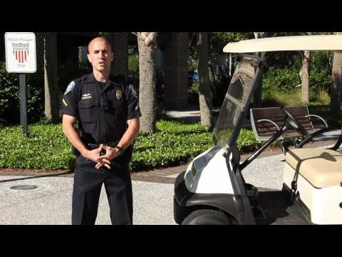
Golf Cart Laws
To help keep everyone safe, the Mount Pleasant Police Department would like to remind everyone of the South Carolina laws governing golf...
-
Have you ever received a strange email or phone call where the other person knew several key pieces of information about you but you c...
-
The Mount Pleasant Police Department is seeking the public's help in identifying the man in the above video...